Golden sandy tidal flats surrounded by lush green hills

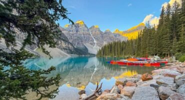
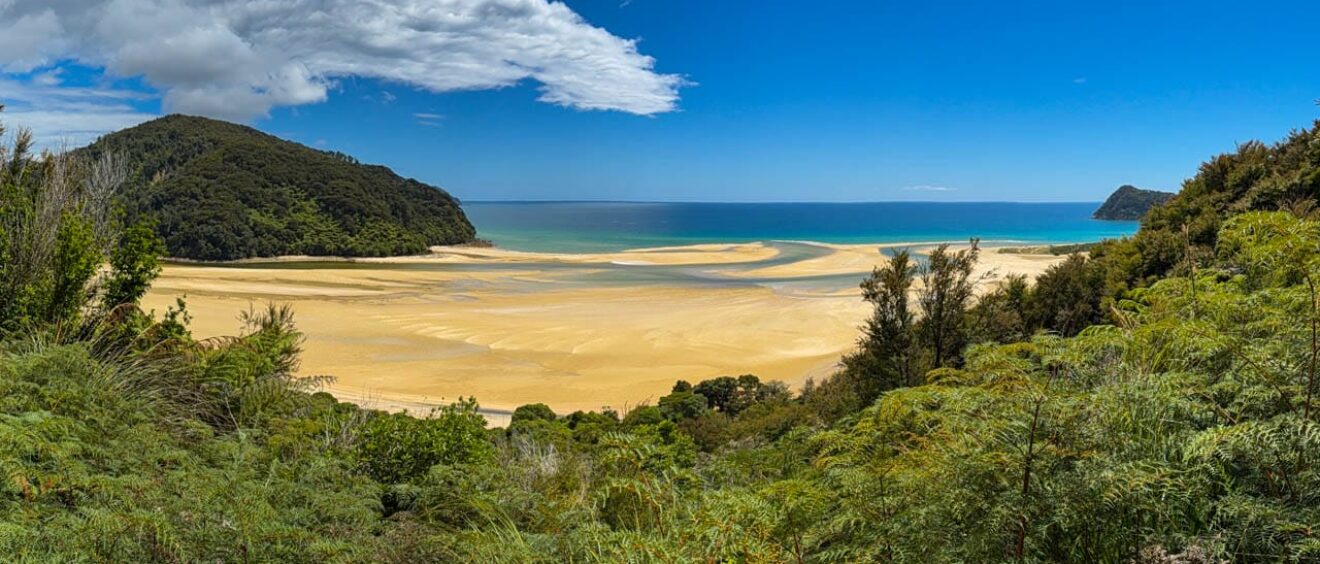
Hiking the Abel Tasman Coast Track (well, part of it)

 
As we left Kaikoura, the weather shifted back to windy and rainy conditions, setting the tone for our 3-hour scenic drive to Nelson. Nelson was a strategic stop for us: We planned to drop off our rental car and leave most of our luggage at the hotel, returning to collect it after our time in the park.


We checked into the Harbourside Lodge, conveniently located in the marina and within walking distance to several restaurants. With 315 reviews and a five-star rating, and under $250 a night, it seemed like a steal. The room was lovely, and the manager was incredibly helpful, aiding us in our plans and providing local tips. We packed what we would need for the next three days into a small collapsible duffel bag and left the rest in the office at the lodge.

Marina with docked boats at sunset and mountains

Abel Tasman National Park is named after the Dutch explorer Abel Tasman, the first European to sight New Zealand in 1642. Known for its golden beaches, granite cliffs, and the renowned Abel Tasman Coast Track, this park offers one of New Zealand’s “Great Walks.” The track, spanning 60 kilometres, provides opportunities for both walking and kayaking, featuring stunning views and encounters with native birdlife. We arranged our transportation via the Sea Shuttle, which included a one-hour bus transfer from our lodge in Nelson to Kaiteriteri, the primary launch point for trips into the park.
Sea Shuttle map of Abel Tasman National Park

Screenshot

The weather cleared to perfection as we embarked on the hour and a half journey from Kaiteriteri to Awaroa, making brief stops along the way. Each bay was more scenic than the next. This was not my mental model of New Zealand.
Secluded tropical beach with turquoise water
There were two other passengers travelling to Awaroa Lodge, but they disembarked at Tonga Quarry opting to walk the last part of the journey. This seemed like a great idea and I was jealous of their foresight, especially given the outstanding weather. When we arrived at Awaroa at low-ish tide, the ferry dropped us at the far end of the beach, so we had to wade in.
Tourists wading ashore from boat at sandy beach
Porters met us with a luggage buggy, and from there it was a flat, 15-minute walk through gorgeous forest to the lodge.

Forest trail entrance with Awaroa Lodge sign

Awaroa Lodge is accessible only by walking or water taxi, which enhances the tranquility and seclusion. We booked three nights to allow time for hiking. The Lodge was upscale and reminded us of lodges we’d experienced in Africa, complete with a common lounge, bar, and a restaurant that served three meals daily.
Modern lodge exterior with lush native landscaping
Outdoor patio seating with umbrellas and shade sails
Cozy lodge lounge with modern rustic décor
Indoor-outdoor dining area with wood tables
An outdoor pizza station catered not only to lodge guests but also to passing hikers during the day. The only time it wasn’t completely packed was the rainy day we visited.

Man drinking outside rustic wooden café in forest

One quick word about the food – wow.
Awaroa lodge says it has 26 rooms accommodating up to 74 people, but it felt like a third of that despite being fully booked. The architecture was a surprising mix of modern minimalism and rustic naturalism – think “eco-lodge meets design magazine”.

Modern lodge walkway with wood and metal siding

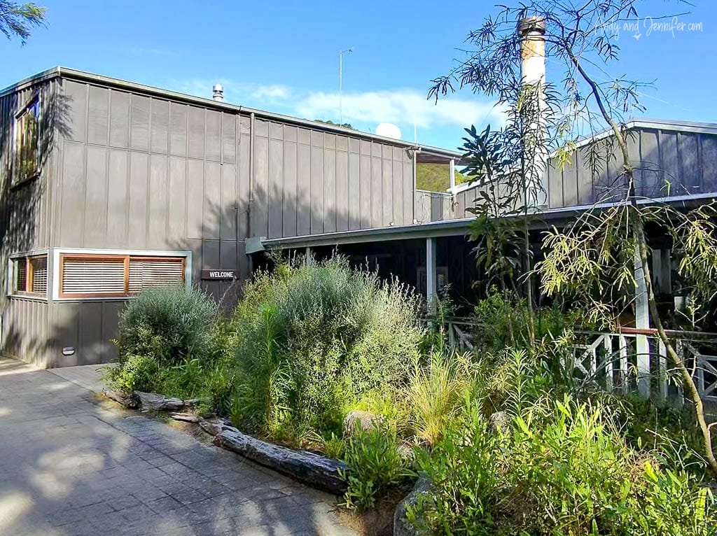
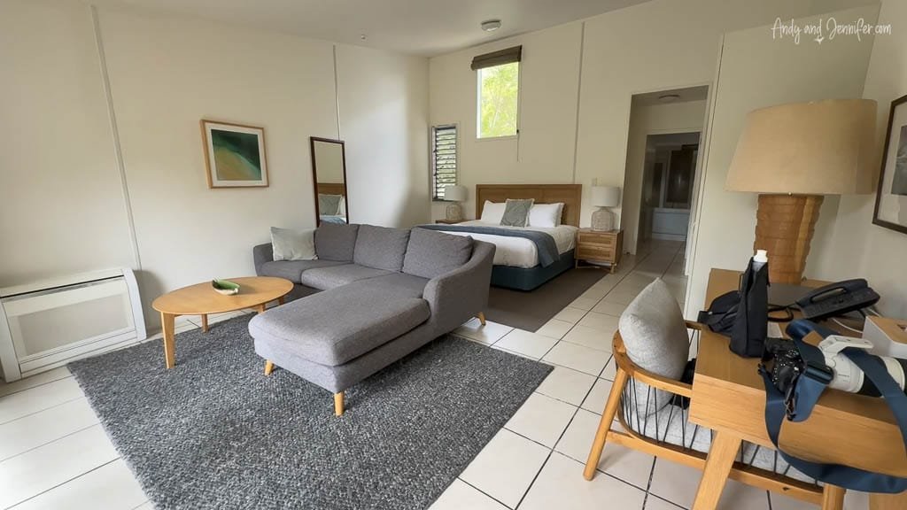
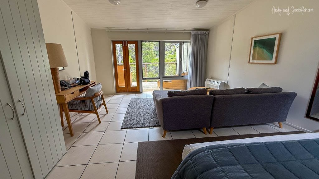
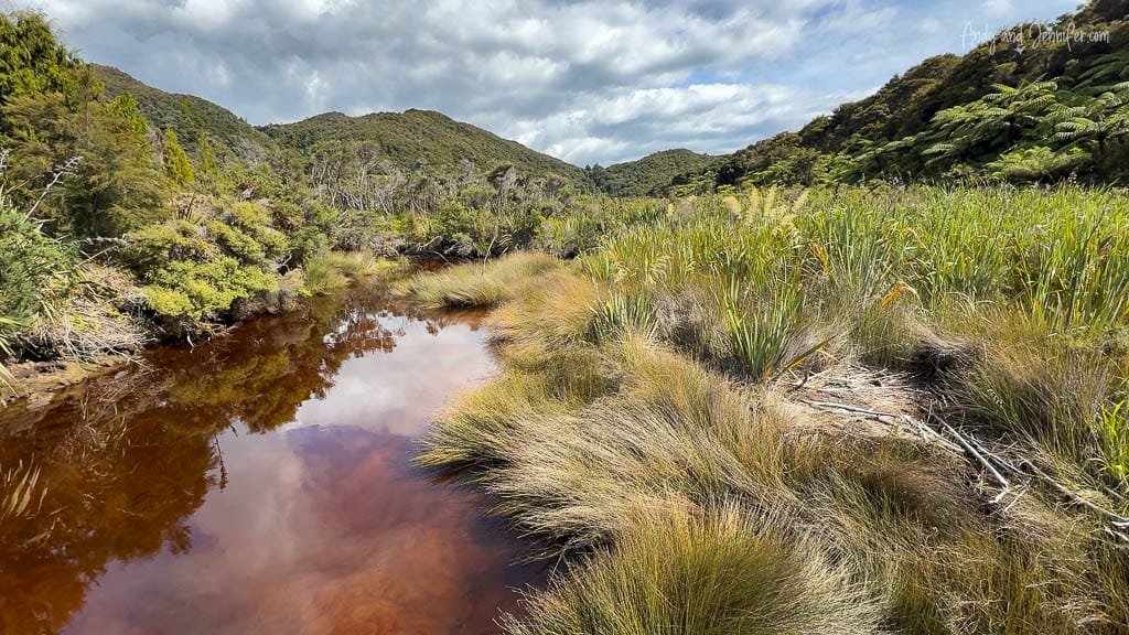
Our “superior” room featured a large sitting area and a terrace overlooking the marsh, providing serene views and a perfect backdrop for relaxation after our hikes.

Modern hotel room with bed, sofa, and workspace
Bright lodge room with sofa and balcony view
The wetlands around the lodge was some of the best we’d experienced for bird photography. We learned to wait near the New Zealand Flax for great shots of tui, bellbird, and silvereye.
Lush green wetland with forest under blue sky


Tui bird perched on flowering flax plant


Bellbird on flax branch with clear blue sky


Silvereye bird resting on lichen-covered branch


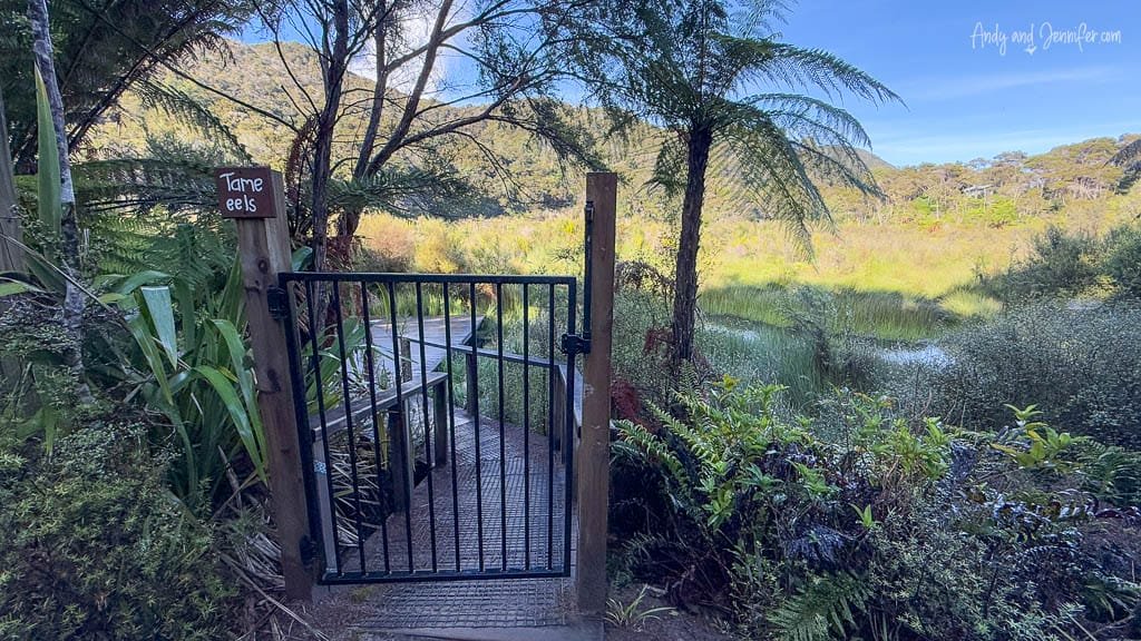
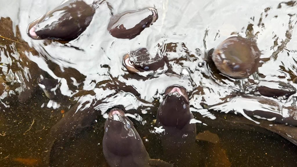
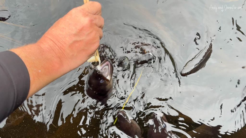
We spotted a sign for “tame eels” and couldn’t resist checking it out, especially after reading in our room’s info sheet that we could grab eel food from the bar. The bartender handed us a ramekin of raw fish and a pair of chopsticks, and off we went.

Turns out, eels are native to New Zealand and thrive in wetlands like those around Awaroa Lodge, where a resident group has become semi-tame. They also carry deep cultural significance for Māori as a traditional food source and symbol of connection to the waterways. Fun fact: The Māori word for eel is tuna.

Gate entrance to tame eel boardwalk in wetland

Group of tame eels surfacing in clear water


Hand feeding tame eel in freshwater stream


Our primary reason for visiting Awaroa was to use it as a comfortable base for day hikes. Over three days, we covered about 40 kilometres according to my watch. The hikes required attention to tidal timings, and we often had to prepare for water crossings by removing our shoes.
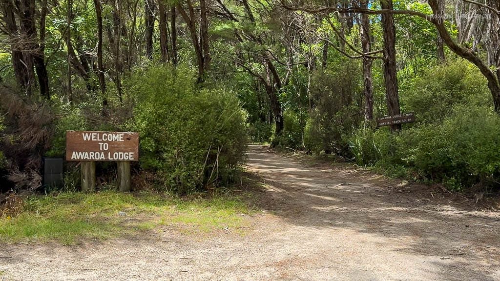
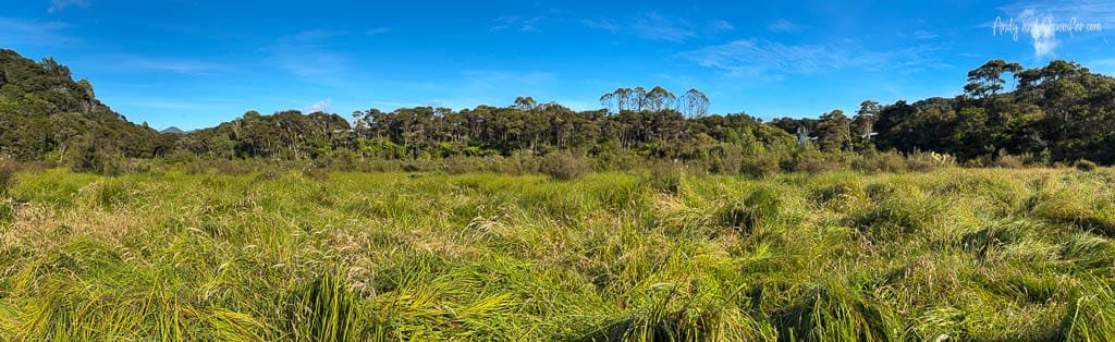
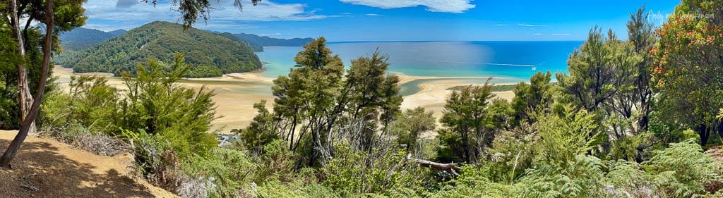
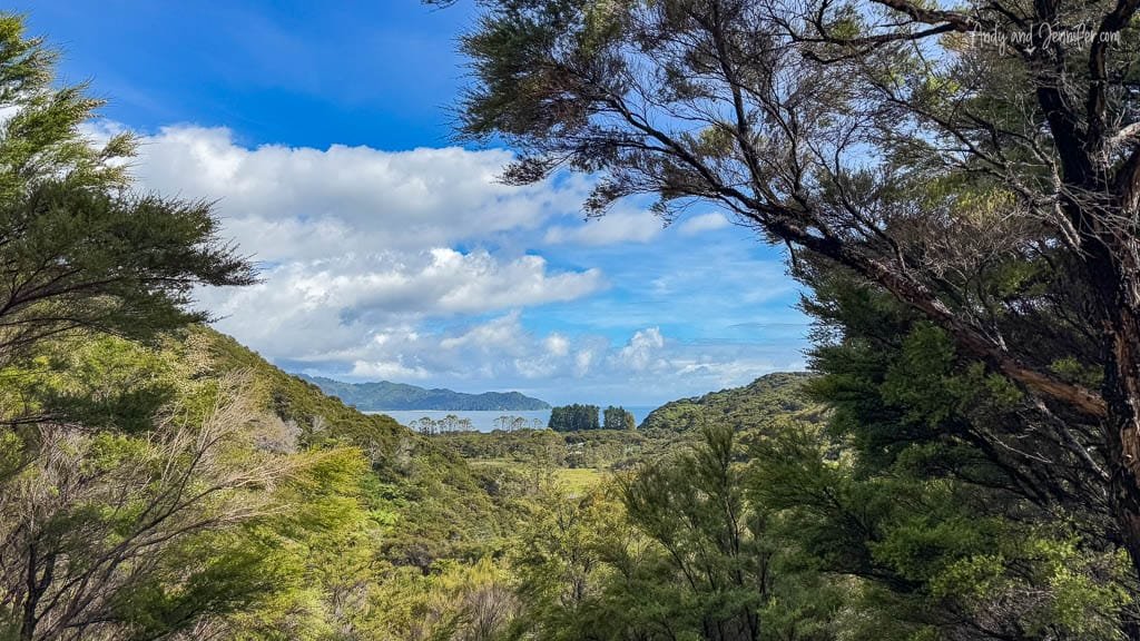
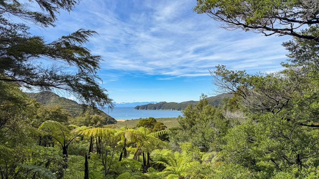
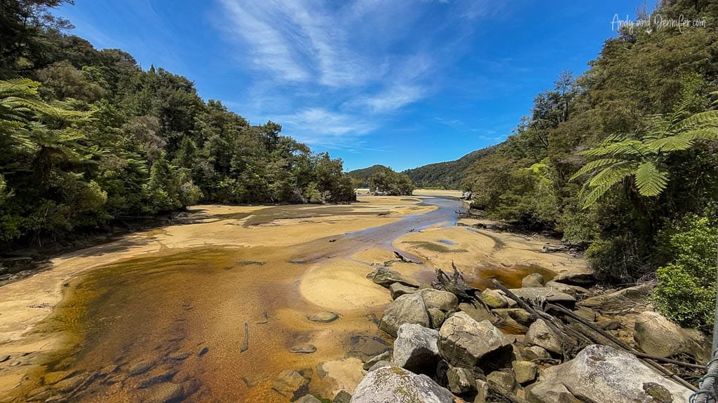
  • Awaroa Loop: This spontaneous hike served to pass time before our room was ready. The trail was relatively flat, passing by the pizza place and eco-glamping sites, and included small water crossings. Once we reached the inlet, we turned onto the high tide track for some low tide views of the inlet. According to my watch, this hike covered 11km and included an altitude gain of 640m.

    Wide sandy estuary at low tide under blue sky
    Coastal forest view overlooking tidal estuary
    Sunlit green fern leaves in native forest
    Scenic forest trail lined with ferns and trees

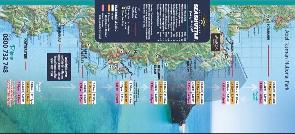
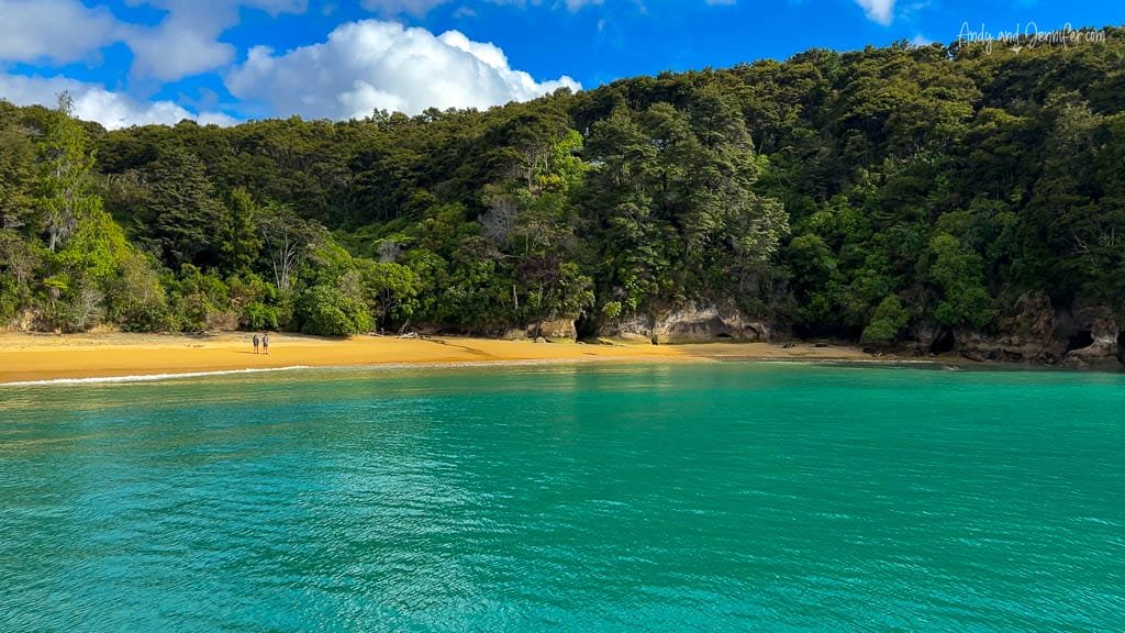
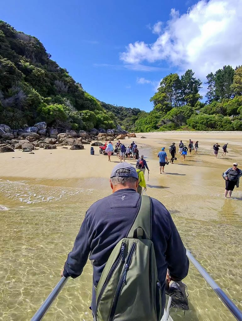
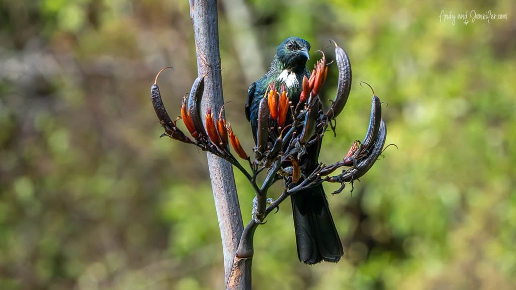
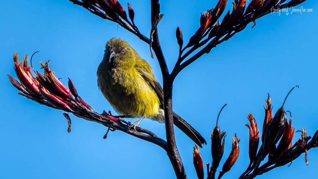
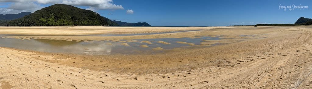
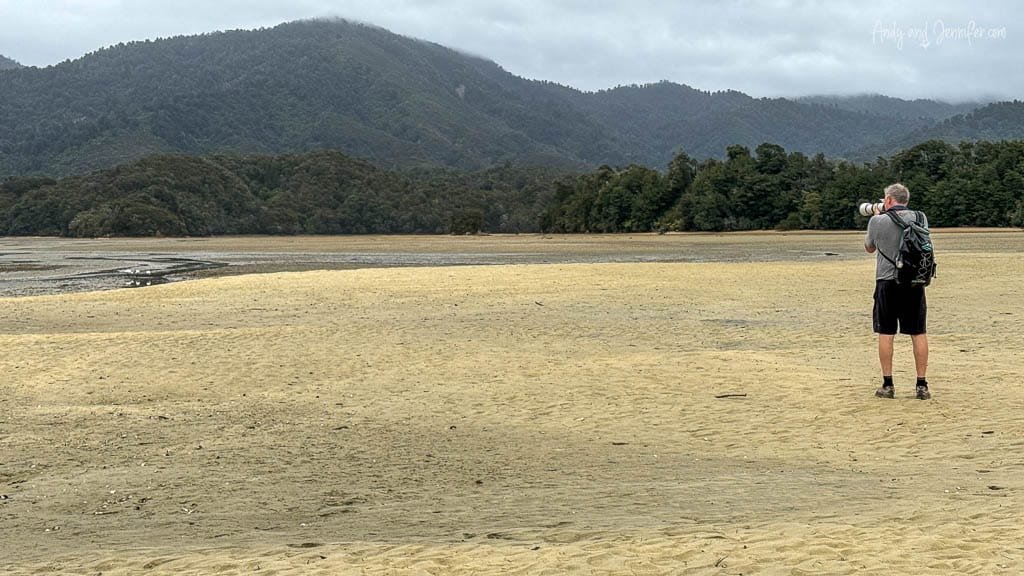
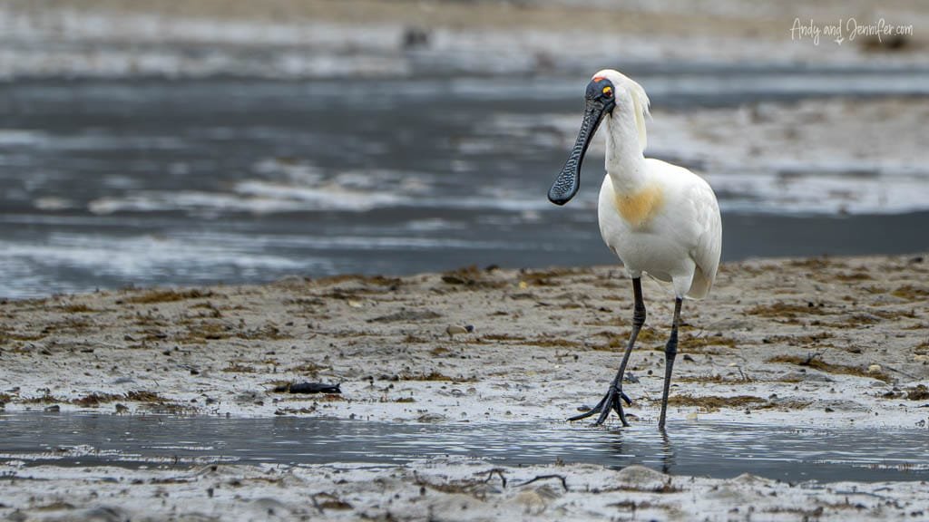
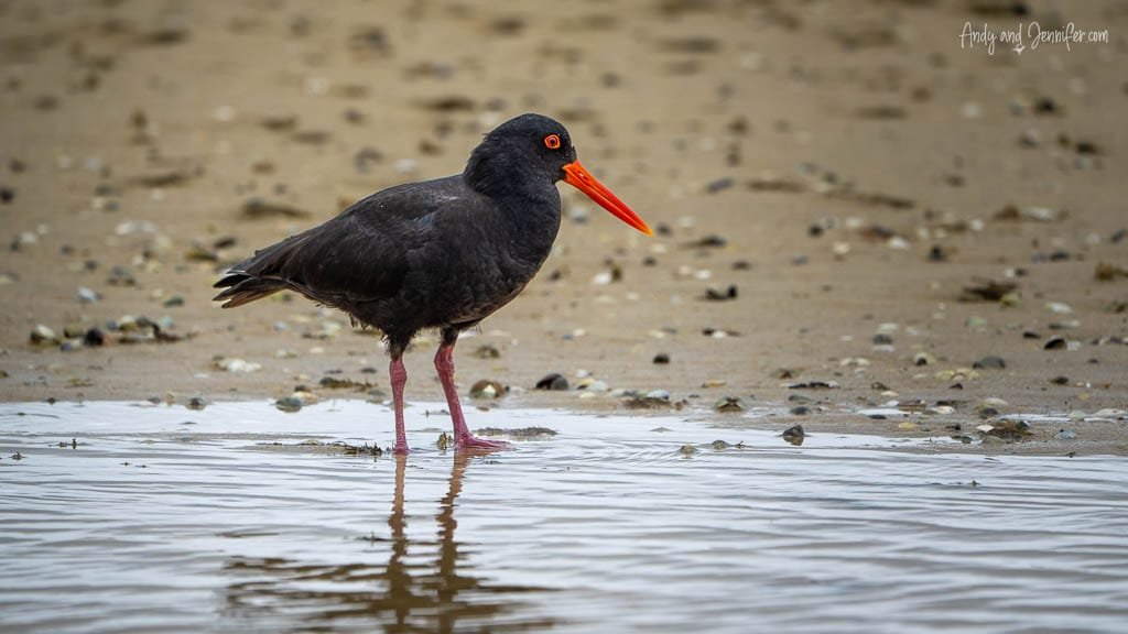
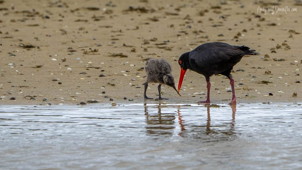
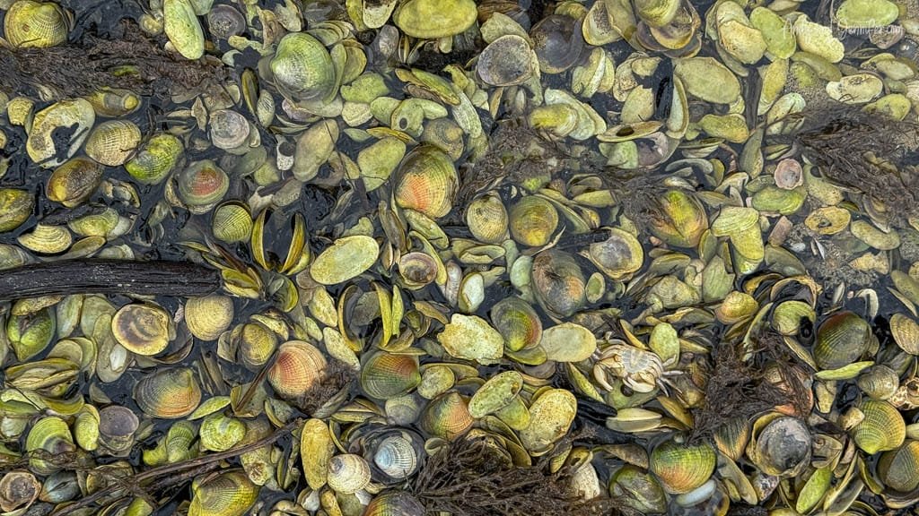
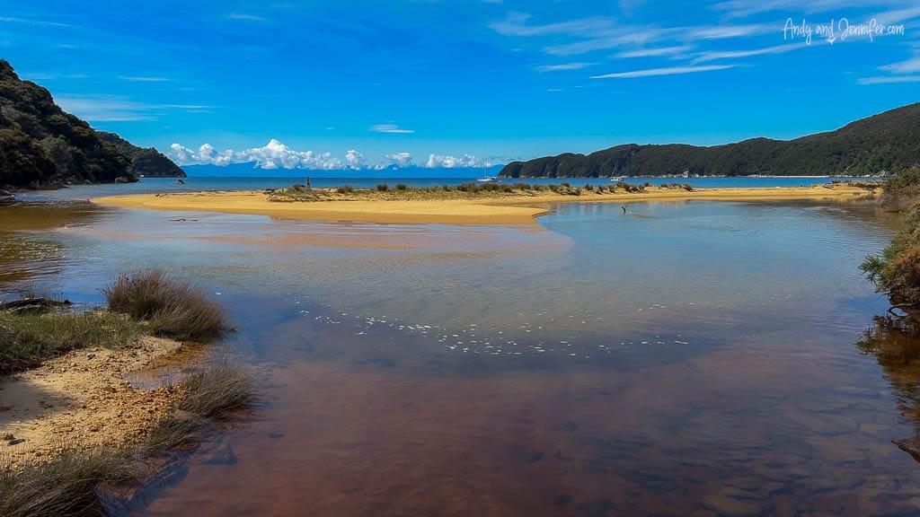
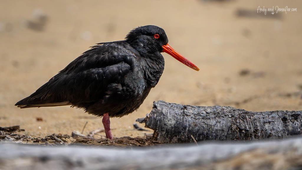
  • Totaranui to Awaroa: For this segment, we opted for a sea shuttle transfer to Totaranui so we could walk one-way back to the lodge. We reached the inlet at low tide, but decided to keep our shoes on as long as possible due to the abundance of shells. The inlet featured unusually relaxed oystercatchers and spoonbills, so we were glad we brought the big camera. We eventually had to take our shoes off to cross a meter-deep channel. We must have missed the most direct route, as my watch reported 12km instead of the 7km we anticipated based on the map.

    Man photographing birds on coastal sandflat

  • Royal spoonbill wading in tidal mudflat
    Bird footprints in wet coastal sand
    Variable oystercatcher standing at water’s edge
    Oystercatcher feeding chick on sandy shore
    Cluster of seashells and crab in shallow water
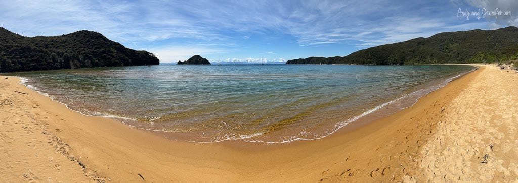
  • Awaroa to Medlands Beach: On our final day, we arranged for a sea shuttle to transport our luggage while we hiked to Medlands Beach for our pickup (kind of the reverse of what that other couple did on arrival). We also arranged for a box lunch and stopped mid way for a snack. Though the map estimated 8.8km, my watch recorded 11.3km with an altitude gain of 641m. The map times were accurate though so we arrived with plenty of time to photograph oystercatchers before boarding the sea shuttle back to Kaiteriteri.

    Forest valley view with distant bay and clouds
    Scenic coastal lookout with ferns and blue sea
    Brown stream winding through lush marshland
    Estuary flowing to sea with sand and hills
    Secluded golden beach with calm turquoise sea
    Ocean bay view framed by native forest trees
    Tidal river winding through lush forest valley
    Oystercatcher on sandy beach near driftwood


With this trip complete, our plans to return and tackle the section from Marahau to Medlands are already brewing, promising yet another adventure in the stunning landscapes of New Zealand.

You may also like